


SUMMARY OF THE WILD MILES:
There are 515 Wild Miles on the Lower Mississippi River between Cairo, Illinois, and Baton Rouge, Louisiana. 71% of the scenery viewed from canoes or kayaks paddling down the river looks & feels wild.
There are 105 Wild Miles on the Lower Mississippi River between St. Louis, Missouri, and Cairo, Illinois. 56% of the scenery viewed from canoes or kayaks paddling down the river looks & feels wild.
INTRODUCTION TO THE WILD MILES:
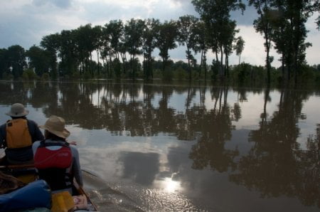
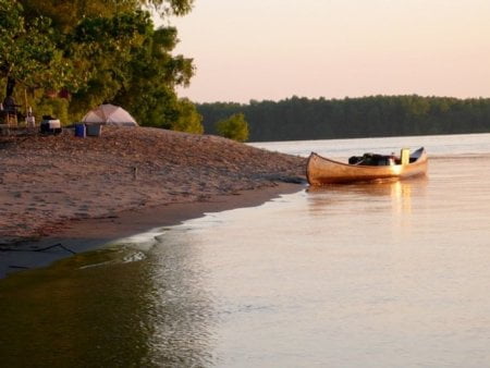
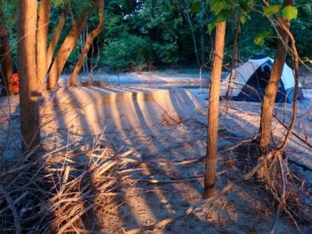
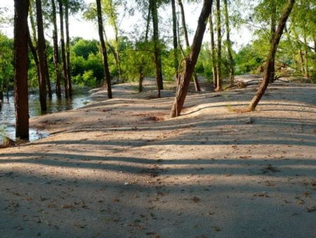
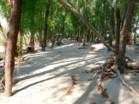
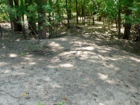
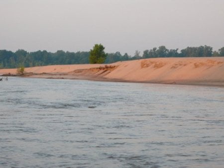
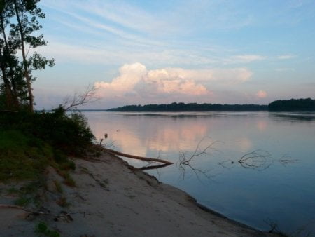
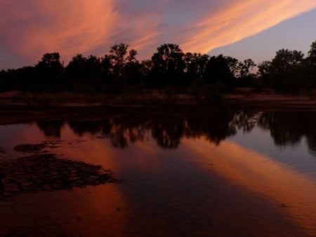
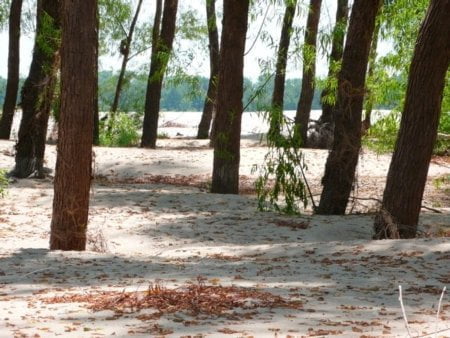
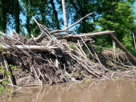
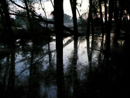
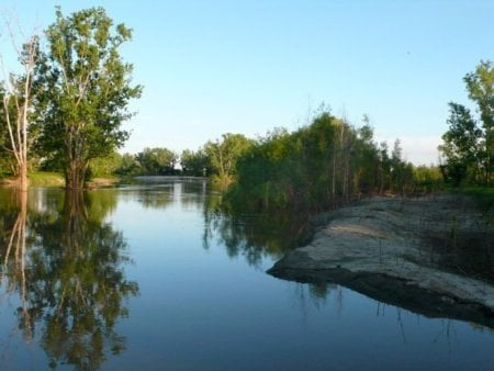
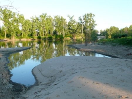
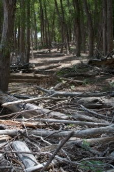
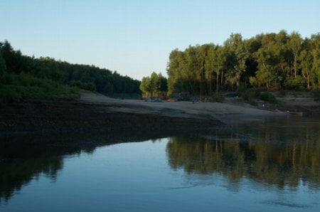
This is a list of the last remaining Wild Miles along the Middle and Lower Mississippi River, places where nature predominates and nothing is seen of mankind save passing tows (and other river traffic) and maybe a tiny hunting camp or a single fisherman buzzing by in a johnboat. These are places where the landscape is filled with giant islands bounded by endless mud banks & sandbars, where the river is overseen by big skies and where the sun sets uninterrupted by buildings or wires and where big river predominates with creative wild beauty, each high water results in shifting sand dunes and re-made sandbars. This is a floodplain valley where only deer & coyote tracks are seen along the sandbars and enormous flocks of shy birds like the White Pelican and Double Breasted Cormorant are comfortable enough to make landing for the night. These are places where it’s dark & quiet at night, where the stars fill the skies like brightly shining jewels poured out on a dark purple velvet blanket, almost as thick & vibrant as the night skies of the Great Plains or Rocky Mountains.
Wild Miles are the kinds of places that the 24 million paddlers in North America will travel long distances to enjoy, and we should preserve for future generations of Americans. In sheer “wild value” the Lower Mississippi ranks alongside the Boundary Waters, the Allagash or the Okeefenokee. The Lower Mississippi Water Trail is at least as important to our national heritage as the Erie Canal, the Santa Fe Trail or the Appalachian Trail. It has been travelled by millions of Americans including the Sioux, the Natchez, and more recently Abe Lincoln, John James Audubon and Langston Hughes, and has always been our single most important route of migration & transportation. It is the life blood of our nation flowing directly from the productive heartland through the cultural flowering of the south and into the vitality of the Gulf of Mexico.
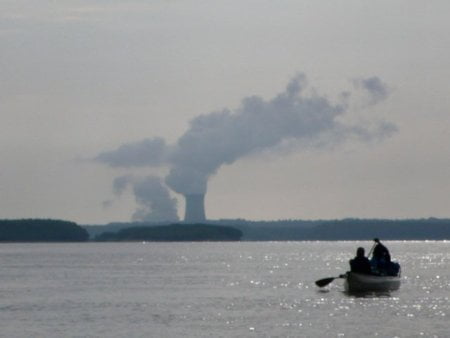
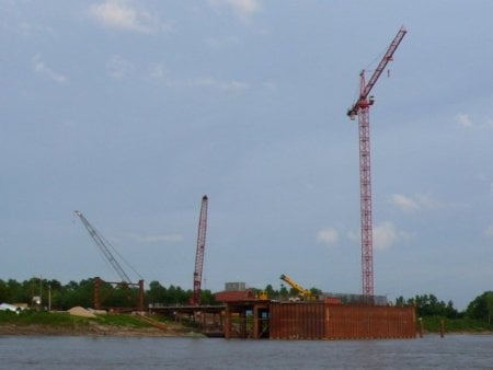
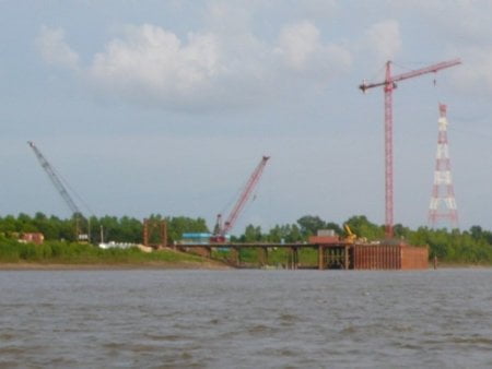
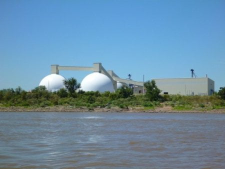
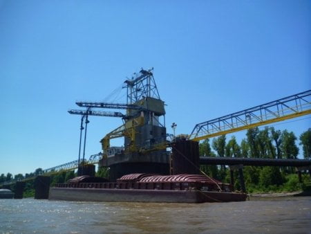
We are identifying these Wild Miles as the focus for future preservation and as the places where new industry & agriculture installations should not be placed. One single smokestack could corrupt the feeling of wildness for miles upstream or downstream. The website https://wildmiles.org will describe the Middle and Lower Mississippi River mile-by-mile with photos, videos and audio clips to document the Wild Miles, and compare the Wild Miles with the “Industrialized Miles.” My last survey was completed in 2009, but we will be updating this entire listing within the year 2012.
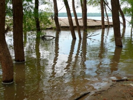
America has an opportunity to find the “wilderness within” by recognizing and preserving the below Wild Miles in the center of the country, and it just so happens that the gigantic floodplain of the Mississippi creates these Wild Miles. These places have been preserved mostly by neglect, by the power of the river, by its catastrophic rises & falls, and the danger of building anything within its floodplain. Moreover, in light of recent flood cycles and the declining population of the Delta, this area is receiving attention as one of the best places to restore native bottomland hardwood forests. Restored forest creates habitat for wildlife, improved water quality, a buffer to flooding, and is an important means of reducing the Gulf of Mexico’s “dead zone,” caused by nutrient runoff into the river.
Developers: Instead of building any new sites within these Wild Miles, please consider placing new industry and agriculture construction within those places already industrialized such as within one of the many harbors along the way, or building it far enough behind the levee that it won’t be seen or heard from the river.
The below mileage corresponds to the mile system used on the 2007 US Army Corps of Engineer River Maps, which can be viewed or downloaded as a pdf.
TOTAL WILD MILES
515 Lower Miss + 101 Middle Miss = 616 Wild Miles Total between St. Louis and Baton Rouge
WHY DO WE CARE ABOUT THE WILD MILES?
Quapaw Canoe Company provides guided canoeing & kayaking on the Middle and Lower Mississippi River, from St. Louis to the Gulf of Mexico. We are based in Clarksdale, Mississippi, with an outpost base in Helena, Arkansas. Big Muddy Adventures is based in St. Louis near the confluence of the Missouri. My name is John Ruskey. I am the founder & owner Quapaw Canoe Company (est. 1998). I first started paddling the Mississippi River with a 5 month raft trip in 1982-83. Mike Clark founded Big Muddy Adventures in 2001 with a 3-month educational expedition down the Mississippi. We guide thousands of visitors every year on the Mississippi River, mostly on overnights and multi-day trips through remote sections of water with little or no industry and agriculture. We employ dozens of guides, shuttle drivers and support staff. We engage and employ local youth through long term-apprenticeships on canoe building, canoe technique & rescue, wilderness survival, and the business of nature-tourism. We help maintain the health of the river system with cleanups and educational campaigns.
We at Quapaw Canoe Company and Big Muddy Adventures are very concerned about the detrimental effects of any future industry along the Middle (St. Louis to Cairo) and Lower Mississippi Rivers (Cairo to the Gulf). Future power plants, steel plants and refineries are of particular concern, but also grain elevators and hydrokinetic turbines. We are concerned about the remaining wild places along the Middle & Lower Mississippi River that might be compromised with any new developments industrial or agricultural.
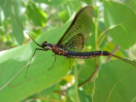
Our clients come from all over America and all over the world to see the Mighty Mississippi River. We call it “America’s Forgotten Wilderness” because the river channels are so big & open, the islands are wild, and there are extensive unbroken forests throughout. There is abundant wildlife. It is one of the last remaining habitats for Black Bear in the center of the country. The Mississippi is the most important flyway in North America. There are hundreds of fish & amphibians. It is our strongest & most vital inland fishery. Most importantly to us and our clients when you are paddling the river it truly feels like a wilderness. It’s big and open. Your imagination is intrigued by the scale of the landscape, similar to what you might feel in the Rocky Mountains or the wilds of Alaska. At night, the stars are visible much brighter than anywhere else in the Middle of America.
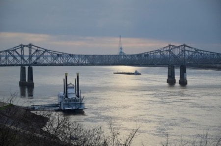
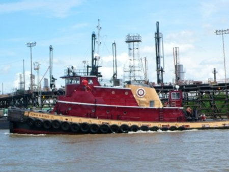
There is towboat activity, of course, but towboats come and go. Any permanent industrial installations within the Wild Miles would change the feeling of wilderness for paddlers & campers with visual and audible pollution. In today’s busy world it is difficult to find wild places where you can leave behind the trappings of civilization and reconnect with those aspects of nature & survival that is so important to the American pysche as defined by Thomas Jefferson and championed by Theodore Roosevelt.
The floodplain of the Lower Mississippi is one of those places that the feeling of wilderness has been preserved –why?
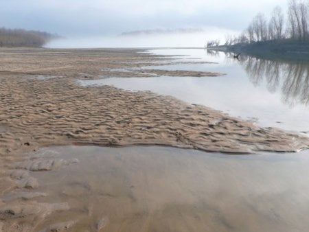
By the power of this dynamic river. Regular high water events have kept most development away. The river fluctuates 40-65 vertical feet in any given year, high water covers most islands and floods most forests & batture areas (the river side of the levee). While the seasonal flooding prohibits industry & agriculture it actually enhances its value as a wilderness – especially for those who can reach its hidden places by water. It is a paddler’s paradise. It is one of America’s greatest paddling challenges. We are certain that it will become a classic destination for canoeists & kayakers alongside popular destinations such as the Boundary Waters, the Adirondacks, and the Everglades.
We enjoy the river as a “forgotten wilderness” and approach it as such with multi-day expeditions by canoe or kayak and primitive camping on remote islands, towheads and sandbars found flung along the banks of the approximately 1200 miles of free-flowing river downstream of St. Louis. Big Muddy Adventures of St. Louis provides the same along the last 340 miles of Missouri River below Kansas City.
RECENT NEWS
WILD MILES IN SOUTHERN LIVING MAGAZINE
LIST OF WILD MILES:
Middle Mississippi
101 Wild Miles within 180 mile section of river
St. Louis to Cairo = 56% Wild
Wild Miles: Approximate mileage on the Middle Mississippi. Subject to revision.
| Mile 136 to 130 | 6 Wild Miles | Above St. Genevieve Note: includes historic Fort DeChartres. The lights of St. Louis can be seen dimly above the northern horizon. |
| Mile 121 to 110 | 9 Wild Miles | below St. Genevieve to above Chester Note: includes Middle Mississippi River National Wildlife Refuge-Kaskaskia Island and other protected public-use islands |
| Mile 105 to 82 | 23 Wild Miles | below Chester to above Grand Tower Note: includes includes Middle Mississippi River National Wildlife Refuge- Rockwood Island and Wilkinson Island as well as other protected public-use islands, parks & campgrounds |
| Mile 80 to 54 | 26 Wild Miles | below Grand Tower to above Cape Girardeau Note: includes protected public-use islands and Trail of Tears State Park |
| Mile 45 to 8 | 37 Wild Miles | below Cape Girardeau to above Cairo |
Lower Mississippi (Cairo to Baton Rouge)
515 Wild Miles within 724 mile section of river
Cairo to Baton Rouge = 71% Wild
Wild Miles: Approximate mileage on the Lower Mississippi. Subject to revision.
| Mile 935 to 925 | 10 Wild Miles | below Columbus to above Hickman |
| Mile 920 to 890 | 30 Wild Miles | below Hickman to above New Madrid Note: Near Reelfoot Lake State Park — frequent bald eagle sightings |
| Mile 882 to 875 | 7 Wild Miles | below New Madrid to above Tiptonville |
| Mile 867 to 850 | 17 Wild Miles | below Tiptonville to above Caruthersville Harbor Note: unbroken forests – very wild feeling |
| Mile 822 to 812 | 10 Wild Miles | below Cape Girardeau to above Cairo |
| Mile 805 to 785 | 20 Wild Miles | Chickasaw National Wildlife Refuge to Osceola Harbor Note: Chickasaw National Wildlife Refuge, 1st Chickasaw Bluff |
| Mile 780 to 740 | 40 Wild Miles | Osceola Harbor to above Memphis Note: Chickasaw National Wildlife Refuge, 1st Chickasaw Bluff, Anderson Tully WMA, 2nd Chickasaw Bluff, Meeman-Shelby Forest State Park, 3rd Chickasaw Bluff, several protected public-use islands including Redman Bar, Loosahatchie Bar and the Hickman Bar. Lights of Memphis seen at night along southern horizon. |
| Mile 725 to 664 | 61 Wild Miles | below Memphis to above Helena Note: Tunica RiverPark & Museum, Buck Island protected public-use island. Some casinos seen. Bright night lights from casinos. lights of Memphis dimly seen along northern horizon. Casino section Mile 708-695 might need to be removed from Wild Miles |
| Mile 650 to 588 | 65 Wild Miles | below Helena Harbor to above Rosedale Harbor Note: White River WMA, Great River Road State Park |
| Mile 583 to 572 | 11 Wild Miles | below Rosedale Harbor to Catfish Point Note: Arkansas River Confluence |
| Mile 568 to 555 | 13 Wild Miles | Catfish Point to Huntington Point Note: Choctaw Island State Wildlife Area – 8,000+ acres – possibly the most beautiful island on the entire Lower Mississippi River |
| Mile 550 to 540 | 10 Wild Miles | Ashbrook to above Greenville Harbor Note: legendary “Greenville Bends” – very wild feeling and lots of wildlife |
| Mile 550 to 540 | 10 Wild Miles | Ashbrook to above Greenville Harbor Note: legendary “Greenville Bends” – very wild feeling and lots of wildlife |
| Mile 530 to 500 | 30 Wild Miles | below Hwy 82 Bridge to above Mayersville |
| Mile 495 to 458 | 10 Wild Miles | below Mayersville to below Willow Island Note: Shipland WMA |
| Mile 455 to 440 | 10 Wild Miles | Forest Home to above Vicksburg Note: Tara Wildlife Preserve |
| Mile 432 to 407 | 25 Wild Miles | below Vicksburg to above Grand Gulf/ Port Gibson Harbor Note: Mouth of the Big Black River, Grand Gulf State Park |
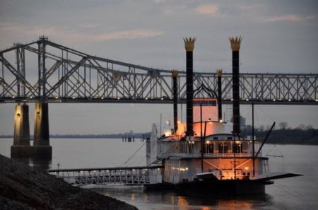
| Mile 402 to 365 | 37 Wild Miles | below Port Gibson Harbor to above Natchez Note: Phatwater Mississippi River Challenge |
| Mile 360 to 320 | 40 Wild Miles | below Natchez to above Old River Note: Red River WMA, 3 Rivers WMA |
| Mile 305 to 267 | 38 Wild Miles | below Old River/Angola to above St. Francisville Note: Very wild — Last Loess Bluff on Mississippi River |
| Mile 259 to 238 | 21 Wild Miles | below St. Francisville to above Baton Rouge |
